


Aerial snow measurements in the Roaring Fork and Fryingpan watersheds indicate a short runoff season this year.
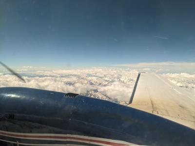
A report from an airborne survey conducted on April 9 shows that snowpack in the upper reaches of both rivers is warmer and smaller than last year. The survey was conducted by Boulder-based Airborne Snow Observatories, a private company operating through contracts with local governments.
The survey area includes the headwaters of the Roaring Fork from the Continental Divide to just above Aspen, as well as the Fryingpan River above Ruedi Reservoir, and the headwaters of Snowmass Creek, Maroon Creek, Castle Creek, Hunter Creek and Woody Creek.
Jeff Deems, a Carbondale resident and chief technical officer for hardware at ASO, said the “cold content” of the snow — a measurement of how much energy is required to melt snow — measured on the day of the survey indicates that much of the watershed’s snowpack is already melting or on the verge of melting.
According to a report from ASO’s survey, the amount of snow in the basin below freezing, or “unripe,” is roughly 10 percentage points lower than last year around the same time. It currently stands at about 26% of the overall snowpack. The rest of that snow is right at, or approaching, its melting point.
“I think we're seeing a fairly warm snowpack this year,” Deems said. “I dug a snow pit on April 9, when the plane was in the air, at 11,000 feet on Richmond Ridge. And most of the snowpack was isothermal — so that is at zero degrees Celsius, at the melting point. There was a very minimal layer in the middle that was a few degrees below freezing.”
Deems said colder snow acts like a buffer against warmer weather in spring months, keeping water locked in snow for longer. Deems said warm spells in January and February this year have heated the snowpack, reducing that buffer.
The National Oceanic and Atmospheric Administration has said that February was the warmest of the 175-year global climate record.
“I've seen here, and in other basins elsewhere in the state, that our snowpack is not as cold as it typically is, which means that the melt is going to get to start earlier than it would in a more typical year,” Deems said.
Runoff could also speed up because of a duststorm that brought dirt and sand from the deserts in the Four Corners area to Aspen in late February and early March. As the sun reveals dust particles embedded in the snow, the dust can absorb sunlight and heat up surrounding snow, causing it to melt. Deems said those dust layers are starting to appear in high concentrations at lower elevations.
The Colorado Dust-on-Snow Program reported an additional dust event hit the local snowpack April 5-7.
This year’s runoff season also will be drier than last year, according to ASO data.
The total amount of water in this year’s snowpack is smaller than last year. The snow water equivalent, or SWE, in the survey area this year was about 520,000 acre-feet on April 9, a roughly 12% drop from the same number taken at the same time last year (the 2023 survey occurred April 11-12).
Deems said the SWE observed in the April 9 flight indicates that this year’s snowpack is smaller than previously thought. Snow telemetry (SNOTEL) sites around the basin show similar snowpack conditions from last year, while the ASO survey shows a clear drop in SWE.
Deems said he thinks the disparity is a result of changing snow distribution patterns, which the SNOTEL sites cannot measure with detail because they are tied to a fixed location.
The sites were the watershed’s only consistent tool for measuring high-altitude snowpack before last year, when ASO operated its first flight over the Roaring Fork watershed. ASO uses an onboard lidar system and spectrometers to measure snow depth, albedo and other variables from a plane flying at 25,000 feet. While data from SNOTEL sites refers only to individual points in a watershed (the locations of the sites themselves), ASO’s model gives a broader picture of the entire survey area, continuously updated with weather data and periodic surveys like the one on April 9.
Water managers at Ruedi Reservoir and the city of Aspen have said detailed ASO data could better inform their water management decisions by giving better predictions of spring runoff. Denver Water has already used ASO flights to help manage Dillon Reservoir in Silverthorne.
This year’s ASO survey, which cost $280,000, was funded by a group of local and state governments. The city of Aspen provided $50,000, the Snowmass Water and Sanitation District provided $12,500, the city of Aurora $24,500, the Southeastern Colorado Water Conservancy District $5,000 and the Colorado Water Conservation Board’s Project Bill $9,600. The CWCB’s Colorado Basin Roundtable contributed the remaining funds through a Water Supply Reserve Fund grant. The CWCB is a state organization.
The city of Aurora made its first contribution this year. Aurora receives water from the Fryingpan watershed through the Ivanhoe Tunnel, which runs under the Continental Divide to the Rockies' eastern slope.
“I'm just finding it fascinating learning more about our hydrology with this complete picture,” Deems said. “Until now, it’s just been slices we’ve had. … Now we're really starting to get that full four-dimensional picture. So it's pretty exciting.”