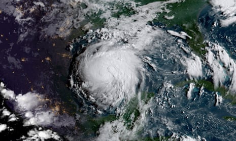
Tropical storm Harvey in the Gulf of Mexico on 24 August. This geocolor image appears differently depending on whether it is day (right of the image) or night (left).
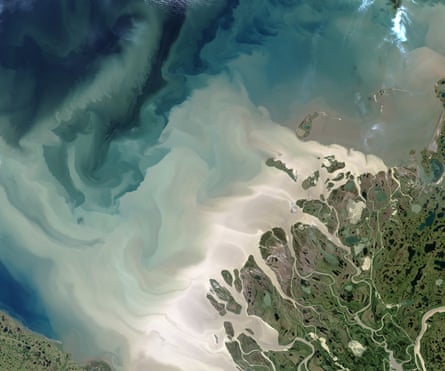
This image of the Mackenzie Delta shows the Beaufort Sea turned milky with sediment from the Mackenzie river. The river is the leading source of freshwater – and sediment – flowing into the Arctic Ocean.
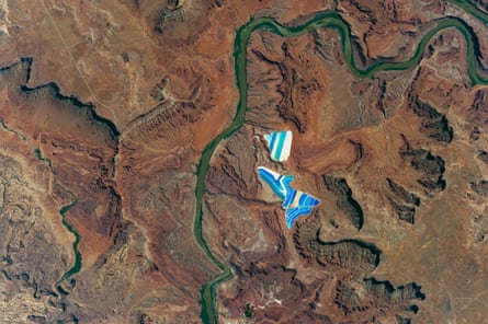
Solar evaporation ponds outside the city of Moab, Utah, part of a large operation to mine potassium chloride, or muriate of potash (MOP), from underground ore. MOP is in high demand as fertiliser because there are no easy substitutes for potassium, an essential nutrient for plant growth. Each pond colour indicates a different state of evaporation. The blue colour comes from a dye that is added to speed up the rate of heat absorption, greens indicate shallower waters well into the evaporation process, and tan ponds are nearly dry – salt crystals (the final product) are left over ready for collection.
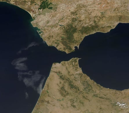
The Strait of Gibraltar separates the southern tip of the Iberian Peninsula from northwestern Africa. At the narrowest point there are just 8.9 miles (14.2 km) between Spain and Morocco.

Mexico’s busiest port, Manzanillo, handles cargo for Mexico City. Numerous tourist hotels dot the curved seafront and main beach. The harbour zone near the city centre is protected by sea walls, and the larger harbour zone, that serves as the main commercial harbour, is protected by another sand spit.
In normal years, Sierra Nevada snow provides a third of California’s water supply. These two images compare snow cover in 2017, when the amount was 173% of normal for that time and in 2016 when it was just 8% of normal.
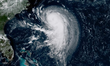
Hurricane Gert in the Atlantic Ocean on 15 August when it had maximum sustained winds of 65 knots with gusts of up to 80 knots.
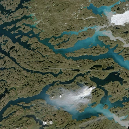
A wildfire burns along Greenland’s western coast. While it is not unprecedented for satellites to observe fire activity in Greenland, a preliminary analysis by Stef Lhermitte of Delft University of Technology in the Netherlands suggests that Modis has detected far more fire activity in Greenland in 2017 than during any other year since the records began in 2000. This area northeast of Sisimiut saw almost no rain in June and half of the usual amount in July, which may have left vegetation dry and more likely to burn.
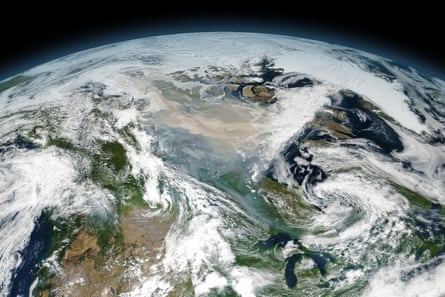
Smoke drifts over northern Canada, as a result of dozens of large wildfires in British Colombia and then the Northwest Territories. The image is a mosaic composed from several satellite overpasses because the affected area is so large.
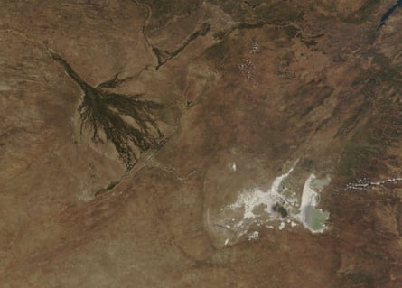
This image of northern Botswana features two striking game reserves: the Moremi (northwest) and the Makgadikgadi Pans (southeast). The tans in the southern section of the image mark the arid Kalahari Desert. The green land north of the two reserves is home to Chobe national park.
Moremi Game Reserve sits on the eastern side of the Okavango Delta, where water from the Okavango river spills on to the dry Kalahari. It is home to a wealth of wildlife, including lion, leopard, spotted hyena, wild dog and cheetah.
The Makgadikgadi Pans form a very different ecosystem.Its salt pans are the remnants of the ancient Lake Makgadikgadi and form one of the largest salt flats in the world. In the rainy season, when the pans fill with water, animals and birds flock there in great numbers timing their migration to make the most of this event.
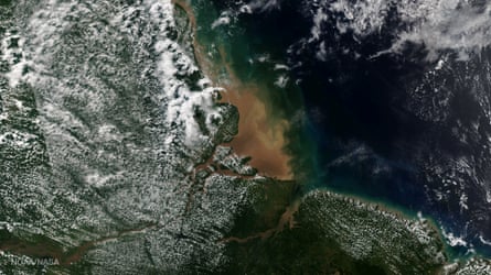
The sediment-rich fresh water of the Amazon mixes with the salt water of the Atlantic at the river’s mouth. Although it looks like it in this image, the Amazon does not form a true delta as the Atlantic has sufficient wave and tidal energy to carry most of the Amazon’s sediments out to sea.

The European port town of Zeebrugge in Belgium. The town has just 4,000 inhabitants but it takes 11,000 people to operate the port, so workers stream in from neighbouring coastal towns. It is the world’s largest port for the import and export of new vehicles, with more than 1.6 million handled in 2010, and it processes more than 50 million tonnes of cargo each year.
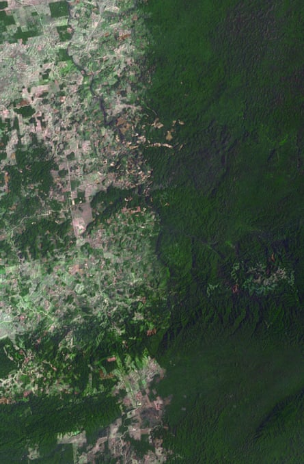
The border between Belize and Guatemala illustrates striking differences in land use practices. Near-pristine forest in Belize on the right and agricultural fields in Guatemala on the left, where forested areas were found to decline 32% in 2016 in a recent study.
