

Southern Manitoba will be in for some strong storms Thursday night and likely into Friday morning.
A system is moving in from south of the border that is likely to bring severe weather in North Dakota.
The National Weather Service released this storm outlook Thursday morning putting a moderate threat of severe weather for much of that state. It also notes a risk of tornado activity in North Dakota.

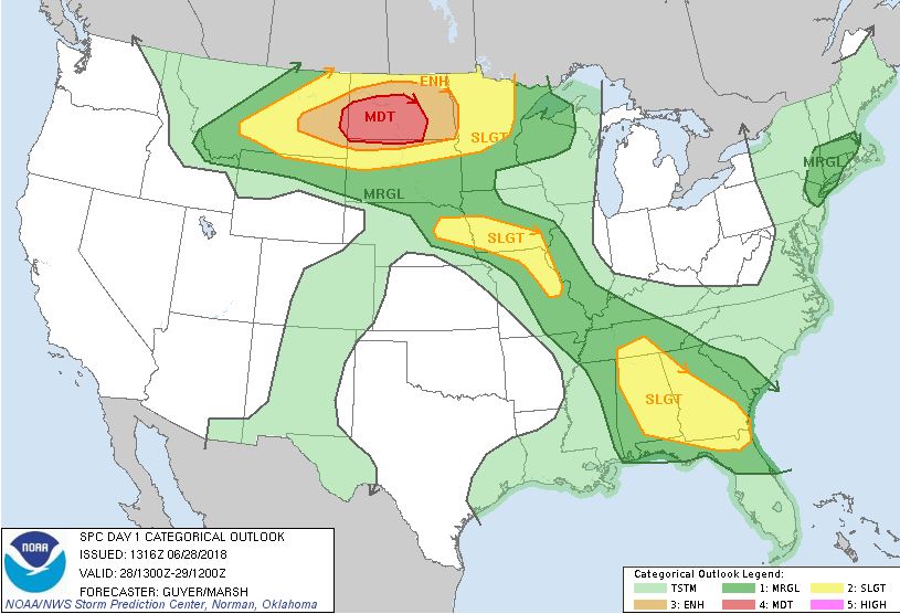
The tornado threat is expected to stay south of the border but southern Manitoba looks likely to receive some severe weather as well.

Thunderstorm activity is likely to start Thursday night in southern Manitoba and carry into Friday morning.
According to Environment and Climate Chance Canada, the greatest threats from these storms will be the potential for golf ball sized hail, torrential downpours of more than 75 millimetres of rain, and wind gusts of 90 to 100 km/h.


Depending how the storms develop over the northern United States, there could be a risk of a very strong second wave of storms in southern Manitoba Friday morning.

The storms are likely to arrive in Winnipeg after midnight with rain and possible thunderstorm activity continuing into Friday morning.
Be aware of thunderstorm watches and warnings in your area. You can stay up to date on incoming severe weather with the Global News Skytracker app.
Comments