Published on
Sep 25, 2026
NOAA flood tool covers nearly 100% of the US
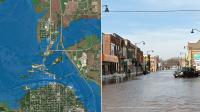
NOAA’s National Weather Service has announced that its Flood Inundation Mapping (FIM) tool, used to predict river flooding, is now available on an experimental basis to nearly 100% of the US population, up from 60% previously. FIM produces estimates of …
Source:
Meteorological Technology International
-
Pending